

Kathmandu Valley is experiencing a gradual yet visible sinking of the ground surface, especially in the central parts of the city.
A Slow Crisis Beneath the Surface
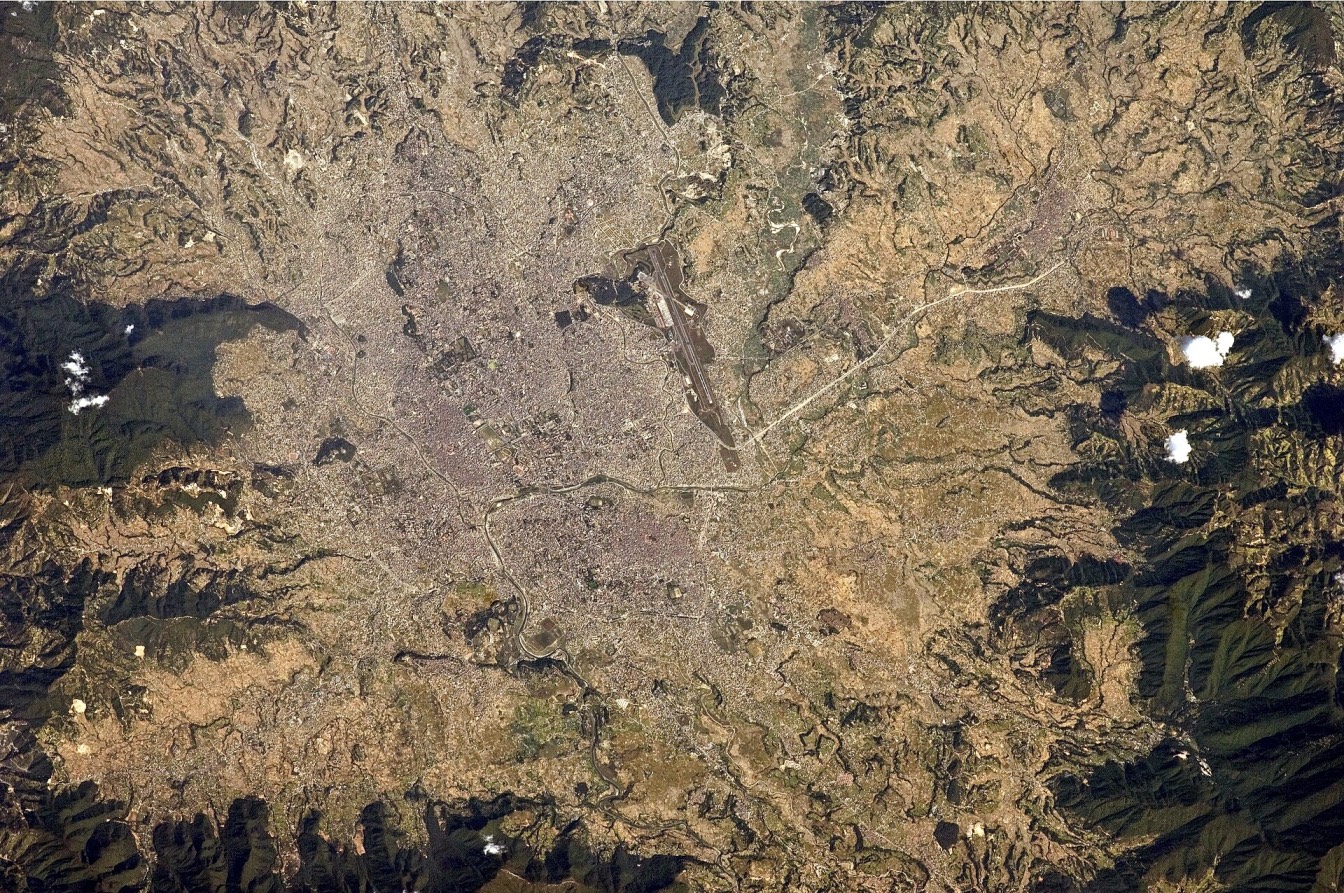
The Kathmandu Valley, which comprises three districts including the national capital, is one of the most densely populated regions in Nepal. Data from 2017 to 2025, based on Sentinel-1 satellite observations, show that parts of the city are sinking by up to 21 centimetres per year. This phenomenon, known as land subsidence, occurs when the ground surface gradually sinks as underlying materials such as soft clay and silt compress or lose water.
This is not an apocalyptic scenario where the city disappears overnight. However, it is a slow-moving environmental and infrastructural crisis that is already affecting buildings, drainage systems, and long-term water security.
The most affected areas include Baluwatar, Samakhusi, Lazimpat, and Dhumbarahi in the northwest, and Gwarko, Patan, and Koteshwor in the south. Over the past seven years, some locations have subsided by more than 1.5 metres. In areas such as Chhauni, Thamel, and Pulchowk, deep tube wellheads now appear to be rising above ground level. In reality, they remain fixed in bedrock while the surrounding soil sinks. This became noticeable in Thamel around 2020.
The problem becomes more visible during the monsoon. In areas such as Samakhushi, Anamnagar, Thamel, and Kamaladi, roads have sunk or collapsed in recent years. A notable example is the road above the Tukucha River in Kamaladi, where a section gave way. While poor drainage contributes, the underlying issue is soil degradation from water loss and pressure, which is worsened by heavy rainfall.
Groundwater, Growth, and a Sinking City
Kathmandu has long depended on groundwater, which supplies a significant portion of its water needs. Records show that extraction increased from 2.3 million litres per day in 1979 to nearly 58.8 million litres per day in 2021. As deep tube wells extract water faster than it can be replenished, clay and silt layers compact. The loss of pore-water pressure causes soft sediments to collapse, leading to surface subsidence.
Urban expansion has intensified the problem. Since 1990, the built-up area has grown by more than 300 per cent, replacing rice fields, wetlands, and open spaces. Between the late 1990s and 2021, the number of houses in Kathmandu Metropolitan City rose to over 70,000, far exceeding sustainable limits. Increased construction has reduced the land’s ability to absorb rainwater, limiting groundwater recharge and worsening flood risks during the monsoon.
Geologically, the valley sits on soft alluvial deposits left by an ancient lake. Thick layers of clay and silt lie beneath the city and compress easily when water is removed. Areas experiencing the fastest subsidence often correspond to zones with deeper sediment layers and heavy groundwater extraction.
What Lies Ahead
Although subsidence is gradual, its impacts are serious. Roads crack, bridges shift, and pipelines and sewer systems weaken as foundations settle unevenly. Lower ground levels also worsen waterlogging. In a seismically active country, weakened ground conditions could amplify damage during future earthquakes.
There is still time to act. The Melamchi water project has helped reduce reliance on groundwater, though supply disruptions persist. Reviving traditional water systems such as ponds and stone spouts, and preserving open spaces, can support natural recharge.
Stronger regulation of groundwater extraction, better enforcement of building laws, and protection of riverbanks and wetlands are essential. Incorporating subsidence risks into urban planning and using monitoring tools such as InSAR can help identify them early.
Kathmandu is not facing an immediate disaster, but it is sending a clear warning. Ignoring it could allow the ground beneath the city to continue sinking, putting homes, heritage, and future development at risk.
